IBRA is updated periodically based on new data, mapping improvements, and review of the existing scheme. The most recent version is IBRA7, developed during 2012, which replaced IBRA6.1.
This is a list of region and subregions under IBRA7. Region codes are given in parentheses, followed by area, where known. Images of regions are from IBRA6.1, pending creation of maps for IBRA7.
| IBRA regions and subregions: IBRA7
|
| IBRA region / subregion |
IBRA code |
Area |
States |
Location in Australia
|
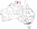
| Arnhem Coast |
ARC |
3,335,669 hectares (8,242,620 acres) |
NT |

|
| Murgenella |
ARC01 |
113,180 ha (279,700 acres)
|
| Maningrida |
ARC02 |
1,741,376 ha (4,303,030 acres)
|
| Nhulunbuy |
ARC03 |
1,159,659 ha (2,865,580 acres)
|
| Groote |
ARC04 |
268,735 ha (664,060 acres)
|
| Wessels |
ARC05 |
52,720 ha (130,300 acres)
|
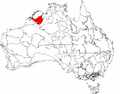
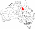
| Arnhem Plateau |
ARP |
2,306,023 hectares (5,698,310 acres) |
NT |
|
| Alligator |
ARP01 |
1,038,621 ha (2,566,490 acres)
|
| Mainoru |
ARP02 |
1,267,401 ha (3,131,820 acres)
|
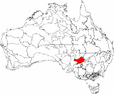
| Australian Alps |
AUA |
1,232,981 hectares (3,046,760 acres) |
NSW, VIC |

|
| Snowy Mountains |
AUA01 |
713,114 ha (1,762,140 acres)
|
| Victorian Alps |
AUA02 |
519,866 ha (1,284,620 acres)
|
| Avon Wheatbelt |
AVW |
9,517,104 hectares (23,517,280 acres) |
WA |

|
| Merredin |
AVW01 |
6,524,175 ha (16,121,590 acres)
|
| Katanning |
AVW02 |
2,992,929 ha (7,395,690 acres)
|
| IBRA regions and subregions: IBRA7
|
| IBRA region / subregion |
IBRA code |
Area |
States |
Location in Australia
|
| Ben Lomond |
BEL |
657,500 hectares (1,625,000 acres) |
TAS |

|
| Ben Lomond (subregion) |
BEL01
|
| Brigalow Belt North |
BBN |
33,790,510 hectares (83,498,200 acres) |
QLD |

|
| Townsville Plains |
BBN01 |
763,495 ha (1,886,640 acres)
|
| Bogie River Hills |
BBN02 |
1,054,392 ha (2,605,460 acres)
|
| Cape River Hills |
BBN03 |
747,393 ha (1,846,850 acres)
|
| Beucazon Hills |
BBN04 |
95,821 ha (236,780 acres)
|
| Wyarra Hills |
BBN05 |
397,935 ha (983,320 acres)
|
| Northern Bowen Basin |
BBN06 |
1,316,957 ha (3,254,270 acres)
|
| Belyando Downs |
BBN07 |
1,772,127 ha (4,379,020 acres)
|
| Upper Belyando Floodout |
BBN08 |
466,275 ha (1,152,190 acres)
|
| Anakie Inlier |
BBN09 |
382,284 ha (944,640 acres)
|
| Basalt Downs |
BBN10 |
1,274,731 ha (3,149,930 acres)
|
| Isaac-Comet Downs |
BBN11 |
2,693,397 ha (6,655,530 acres)
|
| Nebo-Connors Ranges |
BBN12 |
449,269 ha (1,110,170 acres)
|
| South Drummond Basin |
BBN13 |
1,009,244 ha (2,493,900 acres)
|
| Marlborough Plains |
BBN14 |
1,250,611 ha (3,090,330 acres)
|
| Brigalow Belt South |
BBS |
27,219,776 hectares (67,261,530 acres) |
QLD / NSW |

|
| Claude River Downs |
BBS01 |
1,026,214 ha (2,535,830 acres)
|
| Woorabinda |
BBS02 |
749,785 ha (1,852,760 acres)
|
| Boomer Range |
BBS03 |
220,541 ha (544,970 acres)
|
| Mount Morgan Ranges |
BBS04 |
1,275,970 ha (3,153,000 acres)
|
| Callide Creek Downs |
BBS05 |
30,133 ha (74,460 acres)
|
| Arcadia |
BBS06 |
715,288 ha (1,767,520 acres)
|
| Dawson River Downs |
BBS07 |
982,807 ha (2,428,570 acres)
|
| Banana-Auburn Ranges |
BBS08 |
1,547,555 ha (3,824,090 acres)
|
| Buckland Basalts |
BBS09 |
281,306 ha (695,120 acres)
|
| Carnarvon Ranges |
BBS10 |
2,263,686 ha (5,593,690 acres)
|
| Taroom Downs |
BBS11 |
652,005 ha (1,611,140 acres)
|
| Southern Downs |
BBS12 |
4,264,666 ha (10,538,220 acres)
|
| Barakula |
BBS13 |
1,301,712 ha (3,216,600 acres)
|
| Dulacca Downs |
BBS14 |
162,442 ha (401,400 acres)
|
| Weribone High |
BBS15 |
966,510 ha (2,388,300 acres)
|
| Tara Downs |
BBS16 |
511,339 ha (1,263,550 acres)
|
| Eastern Darling Downs |
BBS17 |
1,697,945 ha (4,195,710 acres)
|
| Inglewood Sandstones |
BBS18 |
1,219,008 ha (3,012,230 acres)
|
| Moonie-Commoron Floodout |
BBS19 |
750,661 ha (1,854,920 acres)
|
| Moonie-Barwon Interfluve |
BBS20 |
765,231 ha (1,890,930 acres)
|
| Northern Basalts |
BBS21 |
624,671 ha (1,543,600 acres)
|
| Northern Outwash |
BBS22 |
700,241 ha (1,730,330 acres)
|
| Pilliga Outwash |
BBS23 |
535,392 ha (1,322,980 acres)
|
| Pilliga |
BBS24 |
1,732,137 ha (4,280,200 acres)
|
| Liverpool Plains |
BBS25 |
941,752 ha (2,327,120 acres)
|
| Liverpool Range |
BBS26 |
521,960 ha (1,289,800 acres)
|
| Talbragar Valley |
BBS27 |
203,894 ha (503,830 acres)
|
| Narrandool |
BBS28 |
303,754 ha (750,590 acres)
|
| Broken Hill Complex |
BHC |
5,635,422 hectares (13,925,430 acres) |
SA / NSW |
|
| Barrier Range |
BHC01 |
1,802,996 ha (4,455,300 acres)
|
| Mootwingee Downs |
BHC02 |
630,694 ha (1,558,480 acres)
|
| Scopes Range |
BHC03 |
260,806 ha (644,470 acres)
|
| Barrier Range Outwash |
BHC04 |
1,954,973 ha (4,830,840 acres)
|
| Bimbowrie |
BHC05 |
279,258 ha (690,060 acres)
|
| Curnamona |
BHC06 |
706,696 ha (1,746,280 acres)
|
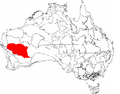
| Burt Plain |
BRT |
7,379,719 hectares (18,235,680 acres) |
NT |

|
| Yuendumu |
BRT01 |
2,931,061 ha (7,242,810 acres)
|
| Atartinga |
BRT02 |
3,531,111 ha (8,725,570 acres)
|
| Mount Chapple |
BRT03 |
390,981 ha (966,140 acres)
|
| Dulcie |
BRT04 |
526,567 ha (1,301,180 acres)
|
| IBRA regions and subregions: IBRA7
|
| IBRA region / subregion |
IBRA code |
Area |
States |
Location in Australia
|
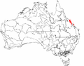
| Cape York Peninsula |
CYP |
12,256,457 hectares (30,286,360 acres) |
QLD |

|
| Coen - Yambo Inlier |
CYP01 |
2,312,126 hectares (5,713,390 acres)
|
| Starke Coastal Lowlands |
CYP02 |
512,498 hectares (1,266,410 acres)
|
| Cape York - Torres Strait |
CYP03 |
94,367 hectares (233,190 acres)
|
| Jardine - Pascoe Sandstones |
CYP04 |
1,444,223 hectares (3,568,750 acres)
|
| Battle Camp Sandstones |
CYP05 |
504,409 hectares (1,246,420 acres)
|
| Laura Lowlands |
CYP06 |
1,791,228 hectares (4,426,220 acres)
|
| Weipa Plateau |
CYP07 |
2,848,753 hectares (7,039,420 acres)
|
| (Northern) Holroyd Plain |
CYP08 |
2,464,074 hectares (6,088,860 acres)
|
| Coastal Plains |
CYP09 |
284,780 hectares (703,700 acres)
|
| Carnarvon |
CAR |
8,430,172 hectares (20,831,410 acres) |
WA |

|
| Cape Range |
CAR01 |
2,380,498 hectares (5,882,340 acres)
|
| Wooramel |
CAR02 |
6,049,674 hectares (14,949,070 acres)
|
| Central Arnhem |
CEA |
3,462,433 hectares (8,555,860 acres) |
NT |

|
| Wilton |
CEA01 |
3,137,973 hectares (7,754,100 acres)
|
| Parson |
CEA02 |
324,460 hectares (801,800 acres)
|
| Central Kimberley |
CEK |
7,675,587 hectares (18,966,790 acres) |
WA |
|
| Pentecost |
CEK01 |
4,397,260 hectares (10,865,900 acres)
|
| Hart |
CEK02 |
2,324,667 hectares (5,744,380 acres)
|
| Mount Eliza (Kimberley) |
CEK03 |
953,661 hectares (2,356,550 acres)
|
| Central Mackay Coast |
CMC |
1,464,208 hectares (3,618,140 acres) |
QLD |
|
| Whitsunday |
CMC01 |
89,179 hectares (220,370 acres)
|
| Proserpine - Sarina Lowlands |
CMC02 |
466,498 hectares (1,152,740 acres)
|
| Clarke - Connors Ranges |
CMC03 |
631,985 hectares (1,561,670 acres)
|
| Byfield |
CMC04 |
127,697 hectares (315,550 acres)
|
| Manifold |
CMC05 |
67,885 hectares (167,750 acres)
|
| Debella |
CMC06 |
80,964 hectares (200,070 acres)
|
| Central Ranges |
CER |
10,164,044 hectares (25,115,900 acres) |
WA, NT, SA |

|
| Mann-Musgrave Block |
CER01 |
9,214,685 hectares (22,769,980 acres)
|
| Wataru |
CER02 |
423,360 hectares (1,046,100 acres)
|
| Everard Block |
CER03 |
525,998 hectares (1,299,770 acres)
|
| Channel Country |
CHC |
30,409,437 hectares (75,143,360 acres) |
NT, QLD, NSW, SA |

|
| Toko Plains |
CHC01 |
2,825,712 hectares (6,982,490 acres)
|
| Sturt Stony Desert |
CHC02 |
8,945,360 hectares (22,104,500 acres)
|
| Goneaway Tablelands |
CHC03 |
5,182,219 hectares (12,805,540 acres)
|
| Diamantina-Eyre |
CHC04 |
1,456,544 hectares (3,599,200 acres)
|
| Cooper-Diamantina Plains |
CHC05 |
4,136,121 hectares (10,220,580 acres)
|
| Coongie |
CHC06 |
1,736,594 hectares (4,291,220 acres)
|
| Lake Pure |
CHC07 |
1,204,027 hectares (2,975,220 acres)
|
| Noccundra Slopes |
CHC08 |
1,798,759 hectares (4,444,830 acres)
|
| Tibooburra Downs |
CHC09 |
|
| Core Ranges |
CHC10 |
139,224 hectares (344,030 acres)
|
| Bulloo |
CHC11 |
1,077,480 hectares (2,662,500 acres)
|
| Bulloo Dunefields |
CHC12 |
1,326,712 hectares (3,278,380 acres)
|
| Central Depression |
CHC13 |
580,685 hectares (1,434,900 acres)
|
| Cobar Peneplain |
COP |
7,385,346 hectares (18,249,590 acres) |
NSW |
|
| Boorindal Plains |
COP1 |
400,236 hectares (989,000 acres)
|
| Barnato Downs |
COP2 |
1,773,542 hectares (4,382,520 acres)
|
| Canbelego Downs |
COP3 |
2,001,425 hectares (4,945,630 acres)
|
| Nymagee |
COP4 |
2,070,061 hectares (5,115,230 acres)
|
| Lachlan Plains |
COP5 |
1,140,082 hectares (2,817,200 acres)
|
| Coolgardie |
COO |
12,912,209 hectares (31,906,760 acres) |
WA |

|
| Mardabilla |
COO1 |
1,843,125 hectares (4,554,460 acres)
|
| Southern Cross |
COO2 |
6,010,838 hectares (14,853,100 acres)
|
| Eastern Goldfields |
COO3 |
5,058,246 hectares (12,499,200 acres)
|
| Coral Sea |
COS |
17,167 hectares (42,420 acres) |
|
|
| IBRA regions and subregions: IBRA7
|
| IBRA region / subregion |
IBRA code |
Area |
States |
Location in Australia
|
| Daly Basin |
DAB |
2,092,229 hectares (5,170,010 acres) |
NT |

|
| Daly Basin |
DAB01
|
| Dampierland |
DAL |
8,360,871 hectares (20,660,160 acres) |
WA |

|
| Fitzroy Trough |
DAL01 |
3,432,084 hectares (8,480,860 acres)
|
| Pindanland |
DAL02 |
4,928,787 hectares (12,179,300 acres)
|
| Darling Riverine Plains |
DRP |
10,699,769 hectares (26,439,710 acres) |
QLD / NSW |

|
| Culgoa-Bokhara |
DRP01 |
1,354,799 hectares (3,347,780 acres)
|
| Warrambool-Moonie |
DRP02 |
1,151,637 hectares (2,845,760 acres)
|
| Castlereagh-Barwon |
DRP03 |
4,500,355 hectares (11,120,620 acres)
|
| Bogan-Macquarie |
DRP04 |
1,999,951 hectares (4,941,990 acres)
|
| Louth Plains |
DRP05 |
276,573 hectares (683,430 acres)
|
| Wilcannia Plains |
DRP06 |
504,562 hectares (1,246,800 acres)
|
| Menindee |
DRP07 |
653,935 hectares (1,615,910 acres)
|
| Great Darling Anabranch |
DRP08 |
147,138 hectares (363,590 acres)
|
| Pooncarie-Darling |
DRP09 |
110,819 hectares (273,840 acres)
|
| Darwin Coastal |
DAC |
2,843,199 hectares (7,025,700 acres) |
NT |

|
| Darwin Coastal |
DAC01
|
| Davenport Murchison Ranges |
DMR |
5,805,108 hectares (14,344,730 acres) |
NT |

|
| Ashburton Range |
DMR01 |
1,218,621 hectares (3,011,280 acres)
|
| Davenport |
DMR02 |
1,589,590 hectares (3,928,000 acres)
|
| Barkly |
DMR03 |
2,996,897 hectares (7,405,490 acres)
|
| Desert Uplands |
DEU |
6,941,095 hectares (17,151,820 acres) |
QLD |

|
| Prairie-Torrens Creeks Alluvials |
DEU01 |
1,580,384 hectares (3,905,210 acres)
|
| Alice Tableland |
DEU02 |
2,866,760 hectares (7,083,900 acres)
|
| Cape-Campaspe Plains |
DEU03 |
1,007,026 hectares (2,488,420 acres)
|
| Jericho |
DEU04 |
1,486,926 hectares (3,674,270 acres)
|
| IBRA regions and subregions: IBRA7
|
| IBRA region / subregion |
IBRA code |
Area |
States |
Location in Australia
|
| Einasleigh Uplands |
EIU |
11,625,726 hectares (28,727,790 acres) |
QLD |

|
| Georgetown - Croydon |
EIU01 |
1,041,407 hectares (2,573,370 acres)
|
| Kidston |
EIU02 |
2,929,528 hectares (7,239,020 acres)
|
| Hodgkinson Basin |
EIU03 |
1,607,221 hectares (3,971,530 acres)
|
| Broken River |
EIU04 |
3,309,590 hectares (8,178,200 acres)
|
| Undara - Toomba Basalts |
EIU05 |
2,076,208 hectares (5,130,420 acres)
|
| Herberton - Wairuna |
EIU06 |
661,771 hectares (1,635,270 acres)
|
| Esperance Plains |
ESP |
2,921,327 hectares (7,218,760 acres) |
WA |

|
| Fitzgerald |
ESP01 |
1,577,938 hectares (3,899,170 acres)
|
| Recherche |
ESP02 |
1,343,390 hectares (3,319,600 acres)
|
| Eyre Yorke Block |
EYB |
6,120,409 hectares (15,123,860 acres) |
SA |

|
| Southern Yorke |
EYB01 |
438,470 hectares (1,083,500 acres)
|
| St Vincent |
EYB02 |
1,093,789 hectares (2,702,810 acres)
|
| Eyre Hills |
EYB03 |
1,172,576 hectares (2,897,500 acres)
|
| Talia |
EYB04 |
1,096,175 hectares (2,708,710 acres)
|
| Eyre Mallee |
EYB05 |
2,319,398 hectares (5,731,360 acres)
|
| IBRA regions and subregions: IBRA7
|
| IBRA region / subregion |
IBRA code |
Area |
States |
Location in Australia
|
| Finke |
FIN |
7,267,416 hectares (17,958,180 acres) |
NT / SA |

|
| Henbury |
FIN01 |
2,257,063 hectares (5,577,320 acres)
|
| Finke River |
FIN02 |
1,601,516 hectares (3,957,430 acres)
|
| Tieyon |
FIN03 |
2,505,610 hectares (6,191,500 acres)
|
| Pedirka |
FIN04 |
903,228 hectares (2,231,920 acres)
|
| Flinders Lofty Block |
FLB |
6,615,765 hectares (16,347,910 acres) |
SA / NSW |
|
| Mount Lofty Ranges |
FLB01 |
300,580 hectares (742,700 acres)
|
| Broughton |
FLB02 |
1,032,918 hectares (2,552,400 acres)
|
| Olary Spur |
FLB02 |
1,745,479 hectares (4,313,170 acres)
|
| Southern Flinders |
FLB04 |
728,317 hectares (1,799,710 acres)
|
| Northern Flinders |
FLB05 |
1,846,804 hectares (4,563,550 acres)
|
| Central Flinders |
FLB06 |
961,667 hectares (2,376,330 acres)
|
| Furneaux |
FUR |
537,543 hectares (1,328,300 acres) |
TAS / VIC |
|
| Wilsons Promontory |
FUR01 |
41,144 hectares (101,670 acres)
|
| Flinders |
FUR02 |
496,398 hectares (1,226,630 acres)
|
| IBRA regions and subregions: IBRA7
|
| IBRA region / subregion |
IBRA code |
Area |
States |
Location in Australia
|
| Gascoyne |
GAS |
18,075,257 hectares (44,664,930 acres) |
WA |

|
| Ashburton |
GAS01 |
3,687,030 hectares (9,110,800 acres)
|
| Carnegie |
GAS02 |
4,718,656 hectares (11,660,050 acres)
|
| Augustus |
GAS03 |
9,669,571 hectares (23,894,030 acres)
|
| Gawler |
GAW |
12,002,883 hectares (29,659,770 acres) |
SA |

|
| Myall Plains |
GAW01 |
1,088,767 hectares (2,690,400 acres)
|
| Gawler Volcanics |
GAW02 |
1,556,182 hectares (3,845,410 acres)
|
| Gawler Lakes |
GAW03 |
2,049,193 hectares (5,063,670 acres)
|
| Arcoona Plateau |
GAW04 |
1,089,865 hectares (2,693,120 acres)
|
| Kingoonya |
GAW05 |
1,922,414 hectares (4,750,390 acres)
|
| Torrens |
GAW06 |
1,439,093 hectares (3,556,080 acres)
|
| Roxby |
GAW07 |
1,409,305 hectares (3,482,470 acres)
|
| Commonwealth Hill |
GAW08 |
1,448,062 hectares (3,578,240 acres)
|
| Geraldton Sandplains |
GES |
3,142,149 hectares (7,764,420 acres) |
WA |

|
| Geraldton Hills |
GES01 |
1,969,997 hectares (4,867,970 acres)
|
| Leseur Sandplain |
GES02 |
1,172,152 hectares (2,896,450 acres)
|
| Gibson Desert |
GID |
15,628,918 hectares (38,619,900 acres) |
WA |

|
| Lateritic Plain |
GID01 |
12,714,805 hectares (31,418,970 acres)
|
| Dune Field |
GID02 |
2,914,114 hectares (7,200,930 acres)
|
| Great Sandy Desert |
GSD |
39,486,135 hectares (97,572,360 acres) |
NT / WA |

|
| McLarty |
GSD01 |
12,316,754 hectares (30,435,360 acres)
|
| Mackay |
GSD02 |
25,698,395 hectares (63,502,120 acres)
|
| Ehrenberg |
GSD03 |
375,668 hectares (928,300 acres)
|
| Amedeus |
GSD04 |
722,845 hectares (1,786,190 acres)
|
| Lake Bennett |
GSD05 |
289,541 hectares (715,470 acres)
|
| Lake Lewis |
GSD06 |
82,932 hectares (204,930 acres)
|
| Great Victoria Desert |
GVD |
42,246,564 hectares (104,393,530 acres) |
SA / WA |

|
| Shield |
GVD01 |
4,741,854 hectares (11,717,380 acres)
|
| Central |
GVD02 |
12,590,867 hectares (31,112,710 acres)
|
| Maralinga |
GVD03 |
11,460,762 hectares (28,320,160 acres)
|
| Kintore |
GVD04 |
4,961,542 hectares (12,260,240 acres)
|
| Tallaringa |
GVD05 |
3,663,149 hectares (9,051,840 acres)
|
| Yellabinna |
GVD06 |
4,828,389 hectares (11,931,210 acres)
|
| Gulf Coastal |
GUC |
2,711,718 hectares (6,700,800 acres) |
NT |

|
| Limmen |
GUC01 |
12,714,805 hectares (31,418,970 acres)
|
| Pellews |
GUC02 |
2,914,114 hectares (7,200,930 acres)
|
| Gulf Fall and Uplands |
GFU |
11,847,909 hectares (29,276,820 acres) |
NT / QLD |

|
| McArthur |
GFU01 |
9,330,938 hectares (23,057,250 acres)
|
| Nicholson |
GFU02 |
2,516,971 hectares (6,219,570 acres)
|
| Gulf Plains |
GUP |
22,041,825 hectares (54,466,540 acres) |
NT / QLD |

|
| Karumba Plains |
GUP01 |
1,057,366 hectares (2,612,810 acres)
|
| Armraynald Plains |
GUP02 |
1,589,437 hectares (3,927,580 acres)
|
| Woondoola Plains |
GUP03 |
2,375,110 hectares (5,869,000 acres)
|
| Mitchell-Gilbert Fans |
GUP04 |
5,262,816 hectares (13,004,700 acres)
|
| Claraville Plains |
GUP05 |
3,738,013 hectares (9,236,830 acres)
|
| Holroyd Plain-Red Plateau |
GUP06 |
2,208,468 hectares (5,457,240 acres)
|
| Doomadgee Plains |
GUP07 |
1,831,823 hectares (4,526,530 acres)
|
| Donors Plateau |
GUP08 |
2,449,964 hectares (6,053,990 acres)
|
| Gilberton Plateau |
GUP09 |
1,403,937 hectares (3,469,200 acres)
|
| Wellesley Islands |
GUP10 |
124,893 hectares (308,620 acres)
|
| IBRA regions and subregions: IBRA7
|
| IBRA region / subregion |
IBRA code |
Area |
States |
Location in Australia
|
| MacDonnell Ranges |
MAC |
3,929,444 hectares (9,709,870 acres) |
NT |

|
| McDonnell |
MAC01 |
1,483,959 hectares (3,666,940 acres)
|
| Watarrka |
MAC02 |
1,092,782 hectares (2,700,320 acres)
|
| Hartz Range |
MAC03 |
1,352,702 hectares (3,342,600 acres)
|
| Mallee |
MAL |
7,397,559 hectares (18,279,770 acres) |
WA |
|
| Eastern Mallee |
MAL01 |
3,415,839 hectares (8,440,720 acres)
|
| Western Mallee |
MAL02 |
3,981,720 hectares (9,839,000 acres)
|
| Mitchell Grass Downs |
MGD |
33,468,761 hectares (82,703,110 acres) |
NT / QLD |

|
| Sylvester |
MGD01 |
1,153,283 hectares (2,849,820 acres)
|
| Barkly Tableland |
MGD02 |
9,479,612 hectares (23,424,630 acres)
|
| Georgina Limestone |
MGD03 |
2,292,026 hectares (5,663,720 acres)
|
| Southwestern Downs |
MGD04 |
3,715,454 hectares (9,181,090 acres)
|
| Kynuna Plateau |
MGD05 |
2,293,311 hectares (5,666,890 acres)
|
| Northern Downs |
MGD06 |
435,263 hectares (1,075,560 acres)
|
| Central Downs |
MGD07 |
9,378,817 hectares (23,175,560 acres)
|
| Southern Wooded Downs |
MGD08 |
4,720,995 hectares (11,665,830 acres)
|
| Mount Isa Inlier |
MII |
6,778,263 hectares (16,749,450 acres) |
QLD |
|
| Southwestern Plateaus and Floodouts |
MII01 |
1,333,519 hectares (3,295,200 acres)
|
| Thorntonia |
MII02 |
802,892 hectares (1,983,990 acres)
|
| Mount Isa |
MII03 |
4,641,851 hectares (11,470,260 acres)
|
| Mulga Lands |
MUL |
25,188,333 hectares (62,241,730 acres) |
NSW / QLD |

|
| West Balonne Plains |
MUL01 |
1,991,194 hectares (4,920,350 acres)
|
| Eastern Mulga Plains |
MUL02 |
1,563,269 hectares (3,862,920 acres)
|
| Nebine Plains, Block Range |
MUL03 |
1,898,731 hectares (4,691,870 acres)
|
| North Eastern Plains |
MUL04 |
660,369 hectares (1,631,810 acres)
|
| Warrego Plains |
MUL05 |
2,492,085 hectares (6,158,080 acres)
|
| Langlo Plains |
MUL06 |
1,290,484 hectares (3,188,860 acres)
|
| Cuttaburra-Paroo |
MUL07 |
1,703,985 hectares (4,210,640 acres)
|
| West Warrego |
MUL08 |
4,790,087 hectares (11,836,560 acres)
|
| Northern Uplands |
MUL09 |
1,147,549 hectares (2,835,660 acres)
|
| West Bulloo |
MUL10 |
2,852,104 hectares (7,047,700 acres)
|
| Urisino Sandplains |
MUL11 |
2,007,350 hectares (4,960,300 acres)
|
| Warrego Sands |
MUL12 |
479,471 hectares (1,184,800 acres)
|
| Kerribree Basin |
MUL13 |
399,576 hectares (987,370 acres)
|
| White Cliffs Plateau |
MUL14 |
1,074,309 hectares (2,654,680 acres)
|
| Paroo Overflow |
MUL15 |
301,217 hectares (744,320 acres)
|
| Paroo-Darling Sands |
MUL16 |
536,556 hectares (1,325,860 acres)
|
| Murchison |
MUR |
28,120,554 hectares (69,487,400 acres) |
WA |
|
| Eastern Murchison |
MUR01 |
21,135,040 hectares (52,225,800 acres)
|
| Western Murchison |
MUR02 |
6,985,514 hectares (17,261,580 acres)
|
| Murray Darling Depression |
MDD |
19,958,349 hectares (49,318,150 acres) |
NSW, SA, VIC |
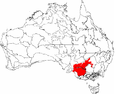
|
| South Olary Plain |
MDD01 |
5,439,224 hectares (13,440,620 acres)
|
| Murray Mallee |
MDD02 |
5,037,583 hectares (12,448,140 acres)
|
| Murray Lakes and Coorong |
MDD03 |
249,191 hectares (615,760 acres)
|
| Lowan Mallee |
MDD04 |
2,391,719 hectares (5,910,070 acres)
|
| Wimmera |
MDD05 |
2,145,380 hectares (5,301,300 acres)
|
| Darling Depression |
MDD06 |
3,662,438 hectares (9,050,080 acres)
|
| Braemer |
MDD07 |
1,032,815 hectares (2,552,140 acres)
|
| IBRA regions and subregions: IBRA7
|
| IBRA region / subregion |
IBRA code |
Area |
States |
Location in Australia
|
| Nandewar |
NAN |
2,701,977 hectares (6,676,730 acres) |
NSW / QLD |

|
| Nandewar Northern Complex |
NAN01 |
962,254 hectares (2,377,780 acres)
|
| Inverell Basalts |
NAN02 |
230,854 hectares (570,450 acres)
|
| Kaputar |
NAN03 |
78,307 hectares (193,500 acres)
|
| Peel |
NAN04 |
1,430,562 hectares (3,535,000 acres)
|
| Naracoorte Coastal Plain |
NCP |
2,458,215 hectares (6,074,380 acres) |
SA / VIC |

|
| Bridgewater |
NCP01 |
463,723 hectares (1,145,880 acres)
|
| Glenelg Plain |
NCP02 |
554,775 hectares (1,370,880 acres)
|
| Lucindale |
NCP03 |
731,656 hectares (1,807,960 acres)
|
| Tintinara |
NCP04 |
708,061 hectares (1,749,660 acres)
|
| New England Tablelands |
NET |
3,002,213 hectares (7,418,630 acres) |
NSW |

|
| Bundarra Downs |
NET01 |
151,867 hectares (375,270 acres)
|
| Beardy River Hills |
NET02 |
24,625 hectares (60,850 acres)
|
| Walcha Plateau |
NET03 |
473,825 hectares (1,170,850 acres)
|
| Armidale Plateau |
NET04 |
290,577 hectares (718,030 acres)
|
| Wongwibinda Plateau |
NET05 |
106,929 hectares (264,230 acres)
|
| Deepwater Downs |
NET06 |
97,773 hectares (241,600 acres)
|
| Glenn Innes-Guyra Basalts |
NET07 |
277,299 hectares (685,220 acres)
|
| Ebor Basalts |
NET08 |
35,709 hectares (88,240 acres)
|
| Moredun Volcanics |
NET09 |
117,461 hectares (290,250 acres)
|
| Severn River Volcanics |
NET10 |
150,795 hectares (372,620 acres)
|
| Northeast Forest Lands |
NET11 |
206,492 hectares (510,250 acres)
|
| Tenterfield Plateau |
NET12 |
139,242 hectares (344,070 acres)
|
| Yarrowyck-Kentucky Downs |
NET13 |
65,135 hectares (160,950 acres)
|
| Binghi Plateau |
NET14 |
64,555 hectares (159,520 acres)
|
| Stanthorpe Plateau |
NET15 |
267,999 hectares (662,240 acres)
|
| Eastern Nandewars |
NET16 |
319,096 hectares (788,500 acres)
|
| Tingha Plateau |
NET17 |
78,461 hectares (193,880 acres)
|
| Nightcap |
NET18 |
113,767 hectares (281,120 acres)
|
| Round Mountain |
NET19 |
20,606 hectares (50,920 acres)
|
| Northern Kimberley |
NOK |
8,420,100 hectares (20,807,000 acres) |
WA |
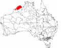
|
| Mitchell |
NOK01 |
5,970,915 hectares (14,754,450 acres)
|
| Berkeley |
NOK02 |
2,449,185 hectares (6,052,070 acres)
|
| NSW North Coast |
NNC |
3,996,591 hectares (9,875,790 acres) |
NSW |

|
| Washpool |
NNC01 |
59,377 hectares (146,720 acres)
|
| Cataract |
NNC02 |
121,338 hectares (299,830 acres)
|
| Dalmorton |
NNC03 |
316,458 hectares (781,980 acres)
|
| Chaelundi |
NNC04 |
188,279 hectares (465,250 acres)
|
| Yuraygir |
NNC05 |
45,815 hectares (113,210 acres)
|
| Coffs Coast and Escarpment |
NNC06 |
308,115 hectares (761,370 acres)
|
| Macleay Hastings |
NNC07 |
729,170 hectares (1,801,800 acres)
|
| Carrai Plateau |
NNC08 |
20,100 hectares (50,000 acres)
|
| Macleay Gorges |
NNC09 |
153,349 hectares (378,930 acres)
|
| Upper Manning |
NNC10 |
83,181 hectares (205,540 acres)
|
| Comboyne Plateau |
NNC11 |
123,315 hectares (304,720 acres)
|
| Mummel Escarpment |
NNC12 |
400,916 hectares (990,690 acres)
|
| Barrington |
NNC13 |
110,903 hectares (274,050 acres)
|
| Tomalla |
NNC14 |
227,615 hectares (562,450 acres)
|
| Ellerston |
NNC15 |
113,183 hectares (279,680 acres)
|
| Upper Hunter |
NNC16 |
232,750 hectares (575,100 acres)
|
| Karuah Manning |
NNC17 |
602,423 hectares (1,488,620 acres)
|
| Rocky River Gorge |
NNC18 |
86,829 hectares (214,560 acres)
|
| Guy Fawkes |
NNC19 |
73,477 hectares (181,570 acres)
|
| NSW South Western Slopes |
NSS |
8,681,126 hectares (21,451,530 acres) |
NSW / VIC |

|
| Inland Slopes |
NSS01 |
4,640,857 hectares (11,467,810 acres)
|
| Lower Slopes |
NSS02 |
3,938,809 hectares (9,733,010 acres)
|
| Capertee Valley |
NSS03 |
101,460 hectares (250,700 acres)
|
| Nullarbor |
NUL |
19,722,774 hectares (48,736,040 acres) |
SA / WA |

|
| Carlisle |
NUL01 |
5,788,547 hectares (14,303,810 acres)
|
| Nullarbor Plain |
NUL02 |
12,785,260 hectares (31,593,100 acres)
|
| Yalata |
NUL03 |
1,148,966 hectares (2,839,160 acres)
|
| IBRA regions and subregions: IBRA7
|
| IBRA region / subregion |
IBRA code |
Area |
States |
Location in Australia
|
| Simpson Strzelecki Dunefields |
SSD |
27,984,283 hectares (69,150,670 acres) |
NSW, NT, QLD, SA |

|
| Andado |
SSD01 |
1,355,195 hectares (3,348,760 acres)
|
| Simpson Desert |
SSD02 |
12,962,073 hectares (32,029,980 acres)
|
| Dieri |
SSD03 |
5,152,029 hectares (12,730,940 acres)
|
| Warriner |
SSD04 |
1,032,165 hectares (2,550,540 acres)
|
| Strzelecki Desert |
SSD05 |
7,482,821 hectares (18,490,450 acres)
|
| South East Coastal Plain |
SCP |
1,749,237 hectares (4,322,460 acres) |
VIC |

|
| Gippsland Plain |
SCP01 |
1,246,995 hectares (3,081,390 acres)
|
| Otway Plain |
SCP02 |
237,799 hectares (587,610 acres)
|
| Warrnambool Plain |
SCP03 |
264,443 hectares (653,450 acres)
|
| South East Corner |
SEC |
2,532,053 hectares (6,256,840 acres) |
NSW / VIC |
|
| East Gippsland Lowlands |
SEC01 |
623,515 hectares (1,540,740 acres)
|
| South East Coastal Ranges |
SEC02 |
1,734,517 hectares (4,286,080 acres)
|
| Bateman |
SEC03 |
174,020 hectares (430,000 acres)
|
| South Eastern Highlands |
SEH |
8,375,961 hectares (20,697,450 acres) |
ACT, NSW, VIC |
|
| Highlands-Southern Fall |
SEH01 |
1,196,334 hectares (2,956,210 acres)
|
| Highlands-Northern Fall |
SEH02 |
1,415,806 hectares (3,498,530 acres)
|
| Otway Ranges |
SEH03 |
149,857 hectares (370,300 acres)
|
| Strzelecki Ranges |
SEH04 |
342,045 hectares (845,210 acres)
|
| Murrumbateman |
SEH06 |
630,454 hectares (1,557,890 acres)
|
| Bungonia |
SEH07 |
431,185 hectares (1,065,480 acres)
|
| Kanangra |
SEH08 |
131,310 hectares (324,500 acres)
|
| Crookwell |
SEH09 |
466,523 hectares (1,152,800 acres)
|
| Oberon |
SEH10 |
293,164 hectares (724,420 acres)
|
| Bathurst |
SEH11 |
161,486 hectares (399,040 acres)
|
| Orange |
SEH12 |
284,172 hectares (702,200 acres)
|
| Hill End |
SEH13 |
504,377 hectares (1,246,340 acres)
|
| Bondo |
SEH14 |
541,990 hectares (1,339,300 acres)
|
| Kybeyan-Gourock |
SEH15 |
479,221 hectares (1,184,180 acres)
|
| Monaro |
SEH16 |
1,267,543 hectares (3,132,170 acres)
|
| Capertee Uplands |
SEH17 |
80,494 hectares (198,910 acres)
|
| South Eastern Queensland |
SEQ |
7,804,921 hectares (19,286,380 acres) |
NSW / QLD |

|
| Burnett-Curtis Hills and Ranges |
SEQ01 |
962,583 hectares (2,378,590 acres)
|
| Moreton Basin |
SEQ02 |
784,969 hectares (1,939,700 acres)
|
| Burringbar-Conondale Ranges |
SEQ03 |
630,616 hectares (1,558,290 acres)
|
| Sunshine Coast-Gold Coast Lowlands |
SEQ04 |
351,123 hectares (867,640 acres)
|
| Brisbane-Barambah Volcanics |
SEQ05 |
806,778 hectares (1,993,590 acres)
|
| South Burnett |
SEQ06 |
563,866 hectares (1,393,340 acres)
|
| Gympie Block |
SEQ07 |
859,020 hectares (2,122,700 acres)
|
| Burnett-Curtis Coastal Lowlands |
SEQ08 |
700,181 hectares (1,730,180 acres)
|
| Great Sandy |
SEQ09 |
356,502 hectares (880,940 acres)
|
| Scenic Rim |
SEQ10 |
614,729 hectares (1,519,030 acres)
|
| Woodenbong |
SEQ11 |
325,603 hectares (804,580 acres)
|
| Clarence Sandstones |
SEQ12 |
327,829 hectares (810,080 acres)
|
| Clarence Lowlands |
SEQ13 |
520,901 hectares (1,287,170 acres)
|
| Southern Volcanic Plain |
SVP |
2,440,340 hectares (6,030,200 acres) |
SA / VIC |
|
| Victorian Volcanic Plain |
SVP01 |
2,356,147 hectares (5,822,170 acres)
|
| Mount Gambier |
SVP02 |
84,194 hectares (208,050 acres)
|
| Stony Plains |
STP |
13,166,372 hectares (32,534,810 acres) |
SA |

|
| Breakaways |
STP01 |
2,444,385 hectares (6,040,210 acres)
|
| Oodnadatta |
STP02 |
2,593,717 hectares (6,409,210 acres)
|
| Murnpeowie |
STP03 |
2,910,385 hectares (7,191,720 acres)
|
| Peake-Dennison Inlier |
STP04 |
158,623 hectares (391,970 acres)
|
| Macumba |
STP05 |
693,282 hectares (1,713,140 acres)
|
| Witjira |
STP06 |
1,677,111 hectares (4,144,230 acres)
|
| Baltana |
STP07 |
2,688,870 hectares (6,644,300 acres)
|
| Sturt Plateau |
STU |
9,857,531 hectares (24,358,490 acres) |
NT |
|
| Renehan |
STU01 |
1,938,959 hectares (4,791,270 acres)
|
| Newcastle |
STU02 |
4,333,836 hectares (10,709,140 acres)
|
| Birdum |
STU03 |
3,584,736 hectares (8,858,080 acres)
|
| Subantarctic Islands |
SAI |
49,164 hectares (121,490 acres) |
NSW / VIC |
|
| Heard and McDonald Islands |
SAI01 |
36,764 hectares (90,850 acres)
|
| Macquarie Island |
SAI02 |
12,400 hectares (31,000 acres)
|
| Swan Coastal Plain |
SWA |
1,525,798 hectares (3,770,330 acres) |
WA |

|
| Dandarragan Plateau |
SWA01 |
383,465 hectares (947,560 acres)
|
| Perth |
SWA02 |
1,142,334 hectares (2,822,770 acres)
|
| Sydney Basin |
SYB |
3,629,597 hectares (8,968,930 acres) |
NSW |
|
| Kerrabee |
SYB01 |
437,384 hectares (1,080,800 acres)
|
| Hunter |
SYB02 |
461,515 hectares (1,140,430 acres)
|
| Wollemi |
SYB04 |
687,622 hectares (1,699,150 acres)
|
| Yengo |
SYB05 |
461,327 hectares (1,139,960 acres)
|
| Wyong |
SYB06 |
211,494 hectares (522,610 acres)
|
| Pittwater |
SYB07 |
148,389 hectares (366,680 acres)
|
| Cumberland |
SYB08 |
275,693 hectares (681,250 acres)
|
| Burragorang |
SYB09 |
257,572 hectares (636,470 acres)
|
| Sydney Cataract |
SYB10 |
153,839 hectares (380,140 acres)
|
| Moss Vale |
SYB11 |
96,903 hectares (239,450 acres)
|
| Illawarra |
SYB12 |
122,752 hectares (303,330 acres)
|
| Ettrema |
SYB13 |
179,126 hectares (442,630 acres)
|
| Jervis |
SYB14 |
135,981 hectares (336,020 acres)
|
 IBRA version 7 map
 IBRA 6.1 regions map


