Chaffee County, Colorado | |
|---|---|
county | |
.JPG) Old Chaffee County Courthouse | |
| Nickname: Heart of the Rockies | |
 Location within the U.S. state of Colorado | |
| Coordinates: 38°44′N 106°11′W / 38.74°N 106.18°W | |
| Country | |
| State | |
| Founded | February 10, 1879 |
| Named after | Jerome B. Chaffee |
| Seat | Salida |
| Largest City | Salida |
| Other cities | Buena Vista Poncha Springs |
| Area | |
• Total | 1,014.95 sq mi (2,628.7 km2) |
| • Land | 1,013.41 sq mi (2,624.7 km2) |
| • Water | 1.54 sq mi (4.0 km2) 0.15% |
| Population | |
• Total | 19,476 |
• Estimate (2024)[3] | 20,780 |
| • Density | 20.47/sq mi (7.90/km2) |
| Time zones | |
| Area code | 719 |
| Congressional district | 7th |
| Website | chaffeecounty.org |
Chaffee County is a county located in the U.S. state of Colorado. As of the 2020 census, the population was 19,476.[2] The county seat is Salida.[4]
History
[edit]Chaffee County has a confusing origin. Between February 8 and 10, 1879, Carbonate County was created by the Colorado legislature out of northern Lake County. On February 10 the two counties were renamed, with the southern part of Lake County becoming Chaffee County, and Carbonate County becoming Lake County. Chaffee County is known as the “Heart of the Rockies”. It was named for Jerome B. Chaffee,[5] Colorado's first United States Senator.
Geography
[edit]According to the U.S. Census Bureau, the county has a total area of 1,014.95 square miles (2,628.7 km2), of which 1,013.41 square miles (2,624.7 km2) is land and 1.54 square miles (4.0 km2) (0.15%) is water.[1]
 Salida, Colorado with Sangre de Cristo Range in background
Adjacent counties
[edit]- Lake County - north
- Park County - northeast
- Fremont County - southeast
- Saguache County - south
- Gunnison County - west
- Pitkin County - northwest
Major highways
[edit]National protected areas
[edit]- Browns Canyon National Monument
- Buffalo Peaks Wilderness
- Collegiate Peaks Wilderness
- San Isabel National Forest
Recreation area
[edit]Trails
[edit]Bicycle routes
[edit]Demographics
[edit]| Census | Pop. | Note | %± |
|---|---|---|---|
| 1880 | 6,512 | — | |
| 1890 | 6,612 | 1.5% | |
| 1900 | 7,085 | 7.2% | |
| 1910 | 7,622 | 7.6% | |
| 1920 | 7,753 | 1.7% | |
| 1930 | 8,126 | 4.8% | |
| 1940 | 8,109 | −0.2% | |
| 1950 | 7,168 | −11.6% | |
| 1960 | 8,298 | 15.8% | |
| 1970 | 10,162 | 22.5% | |
| 1980 | 13,227 | 30.2% | |
| 1990 | 12,684 | −4.1% | |
| 2000 | 16,242 | 28.1% | |
| 2010 | 17,809 | 9.6% | |
| 2020 | 19,476 | 9.4% | |
| 2024 (est.) | 20,780 | [6] | 6.7% |
| U.S. Decennial Census[7] 1790-1960[8] 1900-1990[9] 1990-2000[10] 2010-2020[2] | |||
2020 census
[edit]As of the 2020 census, the county had a population of 19,476. Of the residents, 15.4% were under the age of 18 and 26.7% were 65 years of age or older; the median age was 49.3 years. For every 100 females there were 111.1 males, and for every 100 females age 18 and over there were 112.1 males. 56.4% of residents lived in urban areas and 43.6% lived in rural areas.[11][12][13]
| Race / Ethnicity (NH = Non-Hispanic) | Pop 2000[14] | Pop 2010[15] | Pop 2020[16] | % 2000 | % 2010 | % 2020 |
|---|---|---|---|---|---|---|
| White alone (NH) | 14,174 | 15,417 | 16,195 | 87.27% | 86.57% | 83.15% |
| Black or African American alone (NH) | 257 | 267 | 295 | 1.58% | 1.50% | 1.51% |
| Native American or Alaska Native alone (NH) | 151 | 143 | 132 | 0.93% | 0.80% | 0.68% |
| Asian alone (NH) | 65 | 104 | 133 | 0.40% | 0.58% | 0.68% |
| Pacific Islander alone (NH) | 3 | 8 | 11 | 0.02% | 0.04% | 0.06% |
| Other race alone (NH) | 17 | 12 | 100 | 0.10% | 0.07% | 0.51% |
| Mixed race or Multiracial (NH) | 182 | 180 | 769 | 1.12% | 1.01% | 3.95% |
| Hispanic or Latino (any race) | 1,393 | 1,678 | 1,841 | 8.58% | 9.42% | 9.45% |
| Total | 16,242 | 17,809 | 19,476 | 100.00% | 100.00% | 100.00% |
The racial makeup of the county was 85.7% White, 1.5% Black or African American, 0.9% American Indian and Alaska Native, 0.7% Asian, 0.1% Native Hawaiian and Pacific Islander, 4.0% from some other race, and 7.0% from two or more races. Hispanic or Latino residents of any race comprised 9.5% of the population.[13]
There were 8,411 households in the county, of which 20.6% had children under the age of 18 living with them and 23.4% had a female householder with no spouse or partner present. About 30.1% of all households were made up of individuals and 14.7% had someone living alone who was 65 years of age or older.[12]
There were 10,921 housing units, of which 23.0% were vacant. Among occupied housing units, 73.9% were owner-occupied and 26.1% were renter-occupied. The homeowner vacancy rate was 1.5% and the rental vacancy rate was 9.2%.[12]
2000 census
[edit]At the 2000 census there were 16,242 people, 6,584 households, and 4,365 families living in the county. The population density was 16 people per square mile (6.2 people/km2). There were 8,392 housing units at an average density of 8 per square mile (3.1/km2). The racial makeup of the county was 90.94% White, 1.58% Black or African American, 1.09% Native American, 0.44% Asian, 0.05% Pacific Islander, 4.21% from other races, and 1.69% from two or more races. 8.58% of the population were Hispanic or Latino of any race.[17] Of the 6,584 households 25.20% had children under the age of 18 living with them, 56.70% were married couples living together, 6.80% had a female householder with no husband present, and 33.70% were non-families. 28.40% of households were one person and 11.20% were one person aged 65 or older. The average household size was 2.26 and the average family size was 2.77.
The age distribution was 19.70% under the age of 18, 7.70% from 18 to 24, 28.00% from 25 to 44, 27.50% from 45 to 64, and 17.00% 65 or older. The median age was 42 years. For every 100 females, there were 113.60 males. For every 100 females age 18 and over, there were 116.20 males.
The median household income was $34,368 and the median family income was $42,043. Males had a median income of $30,770 versus $22,219 for females. The per capita income for the county was $19,430. About 7.40% of families and 11.70% of the population were below the poverty line, including 17.30% of those under age 18 and 10.20% of those age 65 or over.
Chaffee County is also home to a source of water that Arrowhead water uses for some water bottles. The source is Ruby Mountain Springs.[18]
Politics
[edit]Chaffee County was long a Republican stronghold, but has recently trended towards the Democrats. In 2008 Barack Obama lost the county by only 11 votes, and he carried it in 2012 by 16 votes, the first Democrat to win it since Lyndon Johnson's 1964 landslide. In 2016 Donald Trump flipped the county narrowly back into the Republican column, but Joe Biden won the county in 2020, the first candidate from either party to win the county by a full majority since 2004. Kamala Harris won the county by a larger margin in 2024, becoming the first Democratic presidential nominee to win the county while losing the presidential election since 1908.
| Year | Republican | Democratic | Third party(ies) | |||
|---|---|---|---|---|---|---|
| No. | % | No. | % | No. | % | |
| 1880 | 1,135 | 48.50% | 1,188 | 50.77% | 17 | 0.73% |
| 1884 | 1,142 | 53.46% | 986 | 46.16% | 8 | 0.37% |
| 1888 | 1,277 | 56.21% | 941 | 41.42% | 54 | 2.38% |
| 1892 | 678 | 40.12% | 0 | 0.00% | 1,012 | 59.88% |
| 1896 | 141 | 5.10% | 2,606 | 94.35% | 15 | 0.54% |
| 1900 | 1,033 | 34.41% | 1,890 | 62.96% | 79 | 2.63% |
| 1904 | 1,611 | 46.90% | 1,601 | 46.61% | 223 | 6.49% |
| 1908 | 1,233 | 38.23% | 1,679 | 52.06% | 313 | 9.71% |
| 1912 | 723 | 21.30% | 1,641 | 48.34% | 1,031 | 30.37% |
| 1916 | 864 | 24.59% | 2,546 | 72.47% | 103 | 2.93% |
| 1920 | 1,501 | 52.91% | 1,233 | 43.46% | 103 | 3.63% |
| 1924 | 1,336 | 43.40% | 612 | 19.88% | 1,130 | 36.71% |
| 1928 | 1,880 | 59.49% | 1,230 | 38.92% | 50 | 1.58% |
| 1932 | 1,061 | 29.24% | 2,393 | 65.96% | 174 | 4.80% |
| 1936 | 1,069 | 29.18% | 2,447 | 66.78% | 148 | 4.04% |
| 1940 | 1,933 | 46.91% | 2,153 | 52.24% | 35 | 0.85% |
| 1944 | 1,675 | 48.83% | 1,731 | 50.47% | 24 | 0.70% |
| 1948 | 2,065 | 57.68% | 1,476 | 41.23% | 39 | 1.09% |
| 1952 | 2,171 | 56.70% | 1,643 | 42.91% | 15 | 0.39% |
| 1956 | 2,284 | 63.67% | 1,303 | 36.33% | 0 | 0.00% |
| 1960 | 2,094 | 52.14% | 1,918 | 47.76% | 4 | 0.10% |
| 1964 | 1,476 | 37.36% | 2,463 | 62.34% | 12 | 0.30% |
| 1968 | 2,121 | 51.07% | 1,667 | 40.14% | 365 | 8.79% |
| 1972 | 2,859 | 66.63% | 1,354 | 31.55% | 78 | 1.82% |
| 1976 | 2,925 | 56.66% | 2,064 | 39.98% | 173 | 3.35% |
| 1980 | 3,327 | 60.73% | 1,583 | 28.90% | 568 | 10.37% |
| 1984 | 3,680 | 66.31% | 1,779 | 32.05% | 91 | 1.64% |
| 1988 | 3,080 | 53.90% | 2,548 | 44.59% | 86 | 1.51% |
| 1992 | 2,419 | 38.51% | 2,284 | 36.36% | 1,579 | 25.14% |
| 1996 | 3,052 | 46.85% | 2,768 | 42.49% | 695 | 10.67% |
| 2000 | 4,300 | 56.50% | 2,768 | 36.37% | 542 | 7.12% |
| 2004 | 4,875 | 55.59% | 3,766 | 42.94% | 129 | 1.47% |
| 2008 | 4,873 | 49.12% | 4,862 | 49.01% | 186 | 1.87% |
| 2012 | 5,070 | 48.46% | 5,086 | 48.61% | 306 | 2.92% |
| 2016 | 5,391 | 47.92% | 4,888 | 43.45% | 971 | 8.63% |
| 2020 | 6,222 | 45.36% | 7,160 | 52.19% | 336 | 2.45% |
| 2024 | 6,034 | 41.84% | 7,992 | 55.41% | 397 | 2.75% |
Communities
[edit] Chaffee County, Colorado
 Buffalo Peaks near Buena Vista
City
[edit]Towns
[edit]Census-designated places
[edit]Unincorporated communities
[edit]Ghost towns
[edit]See also
[edit]- Bibliography of Colorado
- Geography of Colorado
- History of Colorado
- Index of Colorado-related articles
- List of Colorado-related lists
- Outline of Colorado
References
[edit]- ^ a b "State of Colorado Counties – Current/TAB20 – Data as of January 1, 2020". United States Census Bureau. January 1, 2020. Retrieved July 19, 2025.
- ^ a b c "U.S. Census Bureau QuickFacts". U.S. Census Bureau. Retrieved September 4, 2021.
- ^ "Annual Estimates of the Resident Population for Counties in Colorado: April 1, 2020 to July 1, 2024 (CO-EST2024-POP-08)". United States Census Bureau, United States Department of Commerce. March 2025. Retrieved July 19, 2025.
- ^ "Find a County". National Association of Counties. Archived from the original on May 31, 2011. Retrieved June 7, 2011.
- ^ Gannett, Henry (1905). The Origin of Certain Place Names in the United States. Govt. Print. Off. pp. 74.
- ^ "County Population Totals and Components of Change: 2020-2024". United States Census Bureau. Retrieved May 21, 2025.
- ^ "U.S. Decennial Census". United States Census Bureau. Retrieved June 7, 2014.
- ^ "Historical Census Browser". University of Virginia Library. Archived from the original on June 23, 2018. Retrieved June 7, 2014.
- ^ "Population of Counties by Decennial Census: 1900 to 1990". United States Census Bureau. Retrieved June 7, 2014.
- ^ "Census 2000 PHC-T-4. Ranking Tables for Counties: 1990 and 2000" (PDF). United States Census Bureau. Archived (PDF) from the original on March 27, 2010. Retrieved June 7, 2014.
- ^ "2020 Decennial Census Demographic and Housing Characteristics (DHC)". United States Census Bureau. 2023. Retrieved 2025-12-08.
- ^ a b c "2020 Decennial Census Demographic Profile (DP1)". United States Census Bureau. 2021. Retrieved 2025-12-08.
- ^ a b "2020 Decennial Census Redistricting Data (Public Law 94-171)". United States Census Bureau. 2021. Retrieved 2025-12-08.
- ^ "P004: Hispanic or Latino, and Not Hispanic or Latino by Race – 2000: DEC Summary File 1 – Chaffee County, Colorado". United States Census Bureau. Retrieved February 5, 2026.
- ^ "P2 Hispanic or Latino, and Not Hispanic or Latino by Race – 2010: DEC Redistricting Data (PL 94-171) - Chaffee County, Colorado". United States Census Bureau. Retrieved February 5, 2026.
- ^ "P2 Hispanic or Latino, and Not Hispanic or Latino by Race – 2020: DEC Redistricting Data (PL 94-171) - Chaffee County, Colorado". United States Census Bureau. Retrieved February 5, 2026.
- ^ "U.S. Census website". United States Census Bureau. Retrieved May 14, 2011.
- ^ Parker, Bob (September 30, 2020). "A story of biblical dimensions: Chaffee County Citizens vs Nestlé". 350 Colorado. 350 Colorado. Retrieved December 2, 2024.
- ^ Leip, David. "Dave Leip's Atlas of U.S. Presidential Elections". uselectionatlas.org. Retrieved May 26, 2017.
External links
[edit]- State of Colorado
- Cultural, Historical and Archeological Resources
- Chaffee County Clerk of Court
- Chaffee County Government website
- Colorado County Evolution by Don Stanwyck
- Geologic Map of the Harvard Lakes 7.5ʹ Quadrangle, Park and Chaffee Counties, Colorado United States Geological Survey
Municipalities and communities of Chaffee County, Colorado, United States | ||
|---|---|---|
| City | 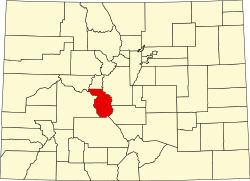 Map of Colorado highlighting Chaffee County Map of Colorado highlighting Chaffee County | |
| Towns | ||
| CDPs | ||
| Unincorporated communities | ||
Places adjacent to Chaffee County, Colorado | ||||||||||||||||
|---|---|---|---|---|---|---|---|---|---|---|---|---|---|---|---|---|
| ||||||||||||||||
| International | |
|---|---|
| National | |
| Other | |