Bacon County, Georgia | |
|---|---|
 Bacon County Courthouse in Alma | |
 Logo | |
 Location within the U.S. state of Georgia | |
| Coordinates: 31°34′N 82°27′W / 31.56°N 82.45°W | |
| Country | |
| State | |
| Founded | July 27, 1914 |
| Named after | Augustus Octavius Bacon |
| Seat | Alma |
| Largest city | Alma |
| Area | |
• Total | 286 sq mi (740 km2) |
| • Land | 259 sq mi (670 km2) |
| • Water | 27 sq mi (70 km2) 9.5% |
| Population (2020) | |
• Total | 11,140 |
| • Density | 43/sq mi (17/km2) |
| Time zone | UTC−5 (Eastern) |
| • Summer (DST) | UTC−4 (EDT) |
| Congressional district | 1st |
| Website | https://baconcounty.org/ |
Bacon County is a county located in the southeastern part of the U.S. state of Georgia. As of the 2020 census, the population was 11,140.[1] The county seat is Alma.[2]
History
[edit]The constitutional amendment to create the county was proposed July 7, 1914, and ratified November 3, 1914. It is named after Augustus Bacon, a former United States senator from Georgia.[3]
Geography
[edit]According to the U.S. Census Bureau, the county has a total area of 286 square miles (740 km2), of which 259 square miles (670 km2) are land and 27 square miles (70 km2) (9.5%) are covered by water.[4]
The majority and western portion of Bacon County is located in the Satilla River sub-basin of the St. Marys River-Satilla River basin. The entire eastern and half of the southeastern edge of the county is located in the Little Satilla River sub-basin of the same St. Marys-Satilla River basin.[5] The county forms part of Southeast Georgia.
Major highways
[edit] U.S. Route 1
 U.S. Route 23
 Georgia State Route 4
 State Route 4 Alternate
 State Route 19
 State Route 32
 State Route 203
Adjacent counties
[edit]- Appling County (northeast)
- Pierce County (southeast)
- Ware County (south)
- Coffee County (west)
- Jeff Davis County (northwest)
Communities
[edit]City
[edit]- Alma (county seat)
Census-designated place
[edit]Unincorporated communities
[edit]Demographics
[edit]| Census | Pop. | Note | %± |
|---|---|---|---|
| 1920 | 6,460 | — | |
| 1930 | 7,055 | 9.2% | |
| 1940 | 8,096 | 14.8% | |
| 1950 | 8,940 | 10.4% | |
| 1960 | 8,359 | −6.5% | |
| 1970 | 8,233 | −1.5% | |
| 1980 | 9,379 | 13.9% | |
| 1990 | 9,566 | 2.0% | |
| 2000 | 10,103 | 5.6% | |
| 2010 | 11,096 | 9.8% | |
| 2020 | 11,140 | 0.4% | |
| 2024 (est.) | 11,045 | [6] | −0.9% |
| U.S. Decennial Census[7] 1790-1880[8] 1890-1910[9] 1920-1930[10] 1930-1940[11] 1940-1950[12] 1960-1980[13] 1980-2000[14] 2010[15] | |||
| Race | Num. | Perc. |
|---|---|---|
| White (non-Hispanic) | 8,103 | 72.74% |
| Black or African American (non-Hispanic) | 1,747 | 15.68% |
| Native American | 4 | 0.04% |
| Asian | 40 | 0.36% |
| Pacific Islander | 4 | 0.04% |
| Other/Mixed | 367 | 3.29% |
| Hispanic or Latino | 875 | 7.85% |
According to the 1920 United States census, the county had a population of 6,460 which has increased since every decennial census except from 1960 and 1970; in 1960, its population declined from 8,940 to 8,359; and in 1970, its population declined to 8,233.
2020 census
[edit]As of the 2020 census, the county had a population of 11,140. Of the residents, 25.4% were under the age of 18 and 17.3% were 65 years of age or older; the median age was 38.6 years. For every 100 females there were 97.9 males, and for every 100 females age 18 and over there were 95.0 males. 0.0% of residents lived in urban areas and 100.0% lived in rural areas.[17][18][19]
The racial makeup of the county was 74.1% White, 15.8% Black or African American, 0.1% American Indian and Alaska Native, 0.4% Asian, 0.0% Native Hawaiian and Pacific Islander, 5.1% from some other race, and 4.5% from two or more races. Hispanic or Latino residents of any race comprised 7.9% of the population.[19]
There were 4,251 households in the county, of which 34.6% had children under the age of 18 living with them and 30.1% had a female householder with no spouse or partner present. About 25.8% of all households were made up of individuals and 11.4% had someone living alone who was 65 years of age or older.[18]
There were 4,807 housing units, of which 11.6% were vacant. Among occupied housing units, 68.3% were owner-occupied and 31.7% were renter-occupied. The homeowner vacancy rate was 0.8% and the rental vacancy rate was 8.6%.[18]
The 2022 American Community Survey estimated its racial and ethnic composition was 73% White, 15% African American, 1% Asian, 3% multiracial, and 9% Hispanic or Latino of any race.[20]
In 2022, the median household income for the county was $43,938 with a per capita income of $24,654. An estimated 21.6% of the county population lived at or below the poverty line. With an estimated 4,807 housing units in the county, 72% were owner-occupied and the median value of an owner-occupied housing unit was $95,600. Approximately 53% of housing units were valued under $100,000.[20]
Religiously, as of 2020, the Association of Religion Data Archives determined the Southern Baptist Convention was the county's largest religious group, being within the Bible Belt.[21] The Church of God (Cleveland, Tennessee) was the second-largest Christian denomination in the county, followed by the Church of Jesus Christ of Latter-day Saints and National Association of Free Will Baptists. Among the county's predominantly Christian population, Methodists, Holiness, and Pentecostal Christians formed the remainder of its religious landscape.
Politics
[edit]| Year | Republican | Democratic | Third party(ies) | |||
|---|---|---|---|---|---|---|
| No. | % | No. | % | No. | % | |
| 1916 | 0 | 0.00% | 287 | 86.19% | 46 | 13.81% |
| 1920 | 219 | 41.63% | 307 | 58.37% | 0 | 0.00% |
| 1924 | 79 | 7.49% | 961 | 91.09% | 15 | 1.42% |
| 1928 | 203 | 39.96% | 305 | 60.04% | 0 | 0.00% |
| 1932 | 11 | 2.08% | 515 | 97.54% | 2 | 0.38% |
| 1936 | 62 | 6.26% | 929 | 93.74% | 0 | 0.00% |
| 1940 | 97 | 10.51% | 821 | 88.95% | 5 | 0.54% |
| 1944 | 220 | 22.38% | 763 | 77.62% | 0 | 0.00% |
| 1948 | 104 | 8.42% | 785 | 63.56% | 346 | 28.02% |
| 1952 | 543 | 26.42% | 1,512 | 73.58% | 0 | 0.00% |
| 1956 | 394 | 13.88% | 2,445 | 86.12% | 0 | 0.00% |
| 1960 | 579 | 33.14% | 1,168 | 66.86% | 0 | 0.00% |
| 1964 | 2,136 | 64.43% | 1,179 | 35.57% | 0 | 0.00% |
| 1968 | 586 | 20.93% | 279 | 9.96% | 1,935 | 69.11% |
| 1972 | 1,771 | 90.22% | 192 | 9.78% | 0 | 0.00% |
| 1976 | 594 | 19.87% | 2,395 | 80.13% | 0 | 0.00% |
| 1980 | 1,427 | 45.94% | 1,622 | 52.22% | 57 | 1.84% |
| 1984 | 1,778 | 63.77% | 1,010 | 36.23% | 0 | 0.00% |
| 1988 | 1,407 | 64.13% | 780 | 35.55% | 7 | 0.32% |
| 1992 | 1,301 | 39.01% | 1,423 | 42.67% | 611 | 18.32% |
| 1996 | 1,580 | 47.07% | 1,360 | 40.51% | 417 | 12.42% |
| 2000 | 2,010 | 67.11% | 956 | 31.92% | 29 | 0.97% |
| 2004 | 2,853 | 75.24% | 930 | 24.53% | 9 | 0.24% |
| 2008 | 3,089 | 78.36% | 817 | 20.73% | 36 | 0.91% |
| 2012 | 3,093 | 78.58% | 791 | 20.10% | 52 | 1.32% |
| 2016 | 3,364 | 83.49% | 608 | 15.09% | 57 | 1.41% |
| 2020 | 4,017 | 86.07% | 625 | 13.39% | 25 | 0.54% |
| 2024 | 4,186 | 86.51% | 645 | 13.33% | 8 | 0.17% |
| Year | Republican | Democratic | Third party(ies) | |||
|---|---|---|---|---|---|---|
| No. | % | No. | % | No. | % | |
| 2020 | 3,929 | 85.60% | 591 | 12.88% | 70 | 1.53% |
| 2020 | 3,569 | 86.46% | 559 | 13.54% | 0 | 0.00% |
| Year | Republican | Democratic | Third party(ies) | |||
|---|---|---|---|---|---|---|
| No. | % | No. | % | No. | % | |
| 2020 | 1,646 | 36.48% | 315 | 6.98% | 2,551 | 56.54% |
| 2020 | 3,572 | 86.47% | 559 | 13.53% | 0 | 0.00% |
| 2022 | 3,204 | 86.36% | 458 | 12.35% | 48 | 1.29% |
| 2022 | 3,047 | 87.36% | 441 | 12.64% | 0 | 0.00% |
| Year | Republican | Democratic | Third party(ies) | |||
|---|---|---|---|---|---|---|
| No. | % | No. | % | No. | % | |
| 2022 | 3,312 | 89.01% | 393 | 10.56% | 16 | 0.43% |
As of the 2020s, Bacon County is a Republican stronghold, voting 86.51% for Donald Trump in 2024. For elections to the United States House of Representatives, Bacon County is part of Georgia's 1st congressional district, currently represented by Buddy Carter. For elections to the Georgia State Senate, Bacon County is part of District 19.[23] For elections to the Georgia House of Representatives, Bacon County is part of District 178.[24]
Education
[edit]See also
[edit]- Bacon County Courthouse
- National Register of Historic Places listings in Bacon County, Georgia
- Bacon County High School
- List of counties in Georgia
References
[edit]- ^ "Census - Geography Profile: Bacon County, Georgia". United States Census Bureau. Retrieved December 26, 2022.
- ^ "Find a County". National Association of Counties. Archived from the original on May 31, 2011. Retrieved June 7, 2011.
- ^ "Bacon County Board of Tax Assessors". Bacon County Board of Tax Assessors. Retrieved February 11, 2023.
- ^ "US Gazetteer files: 2010, 2000, and 1990". United States Census Bureau. February 12, 2011. Retrieved April 23, 2011.
- ^ "Georgia Soil and Water Conservation Commission Interactive Mapping Experience". Georgia Soil and Water Conservation Commission. Archived from the original on October 3, 2018. Retrieved November 27, 2015.
- ^ "County Population Totals and Components of Change: 2020-2024". United States Census Bureau. Retrieved August 22, 2025.
- ^ "Decennial Census of Population and Housing by Decades". US Census Bureau.
- ^ "1880 Census Population by Counties 1790-1800" (PDF). US Census Bureau. 1880.
- ^ "1910 Census of Population - Georgia" (PDF). US Census Bureau. 1910. Archived from the original (PDF) on January 16, 2024.
- ^ "1930 Census of Population - Georgia" (PDF). US Census Bureau. 1930.
- ^ "1940 Census of Population - Georgia" (PDF). US Census Bureau. 1940.
- ^ "1950 Census of Population - Georgia -" (PDF). US Census Bureau. 1950.
- ^ "1980 Census of Population - Number of Inhabitants - Georgia" (PDF). US Census Bureau. 1980.
- ^ "2000 Census of Population - Population and Housing Unit Counts - Georgia" (PDF). US Census Bureau. 2000.
- ^ "State & County QuickFacts". United States Census Bureau. Archived from the original on June 7, 2011. Retrieved June 17, 2014.
- ^ "Explore Census Data". data.census.gov. Retrieved December 18, 2021.
- ^ "2020 Decennial Census Demographic and Housing Characteristics (DHC)". United States Census Bureau. 2023. Retrieved 10 December 2025.
- ^ a b c "2020 Decennial Census Demographic Profile (DP1)". United States Census Bureau. 2021. Retrieved 10 December 2025.
- ^ a b "2020 Decennial Census Redistricting Data (Public Law 94-171)". United States Census Bureau. 2021. Retrieved 10 December 2025.
- ^ a b "Census profile: Bacon County, GA". Census Reporter. Retrieved December 28, 2023.
- ^ "Congregational Membership Reports | US Religion". www.thearda.com. Retrieved December 28, 2023.
- ^ Leip, David. "Dave Leip's Atlas of U.S. Presidential Elections". uselectionatlas.org. Retrieved March 18, 2018.
- ^ "Georgia General Assembly". www.legis.ga.gov. Retrieved November 28, 2025.
- ^ "Georgia General Assembly". www.legis.ga.gov. Retrieved November 28, 2025.
External links
[edit]- Description at georgia.gov Archived May 15, 2016, at the Wayback Machine
- Bacon County historical marker
Places adjacent to Bacon County, Georgia | ||||||||||||||||
|---|---|---|---|---|---|---|---|---|---|---|---|---|---|---|---|---|
| ||||||||||||||||
Municipalities and communities of Bacon County, Georgia, United States | ||
|---|---|---|
| City | 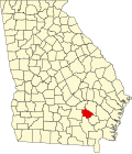 Map of Georgia highlighting Bacon County Map of Georgia highlighting Bacon County | |
| CDP | ||
| Unincorporated community | ||
31°34′N 82°27′W / 31.56°N 82.45°W
| International | |
|---|---|
| National | |
| Other | |